A Drive Through North Shore History: What You'll See Along the Essex Coastal Scenic Byway
There is something remarkable about a road that can take you from one of the oldest working fishing ports in the country to a medieval-style stone castle, a barrier beach backed by dunes, a colonial-era town center, and a long stretch of open Atlantic coastline — all in a single day. That is what the Essex Coastal Scenic Byway delivers, mile by mile, along the Massachusetts North Shore.
The Byway
The Essex Coastal Scenic Byway is a federally designated National Scenic Byway running approximately 90 miles along the coast of Essex County, Massachusetts. It begins in Lynn at the southern end and follows a mix of state and local roads north through more than a dozen coastal communities, ending near Salisbury at the New Hampshire border.
The byway earned its National Scenic Byway designation because of its combination of scenic, historic, recreational, cultural, and natural qualities. Few routes of this length in New England can claim all five. It passes through working harbors, protected salt marshes, preserved colonial streetscapes, and open ocean headlands — often within a few miles of each other.
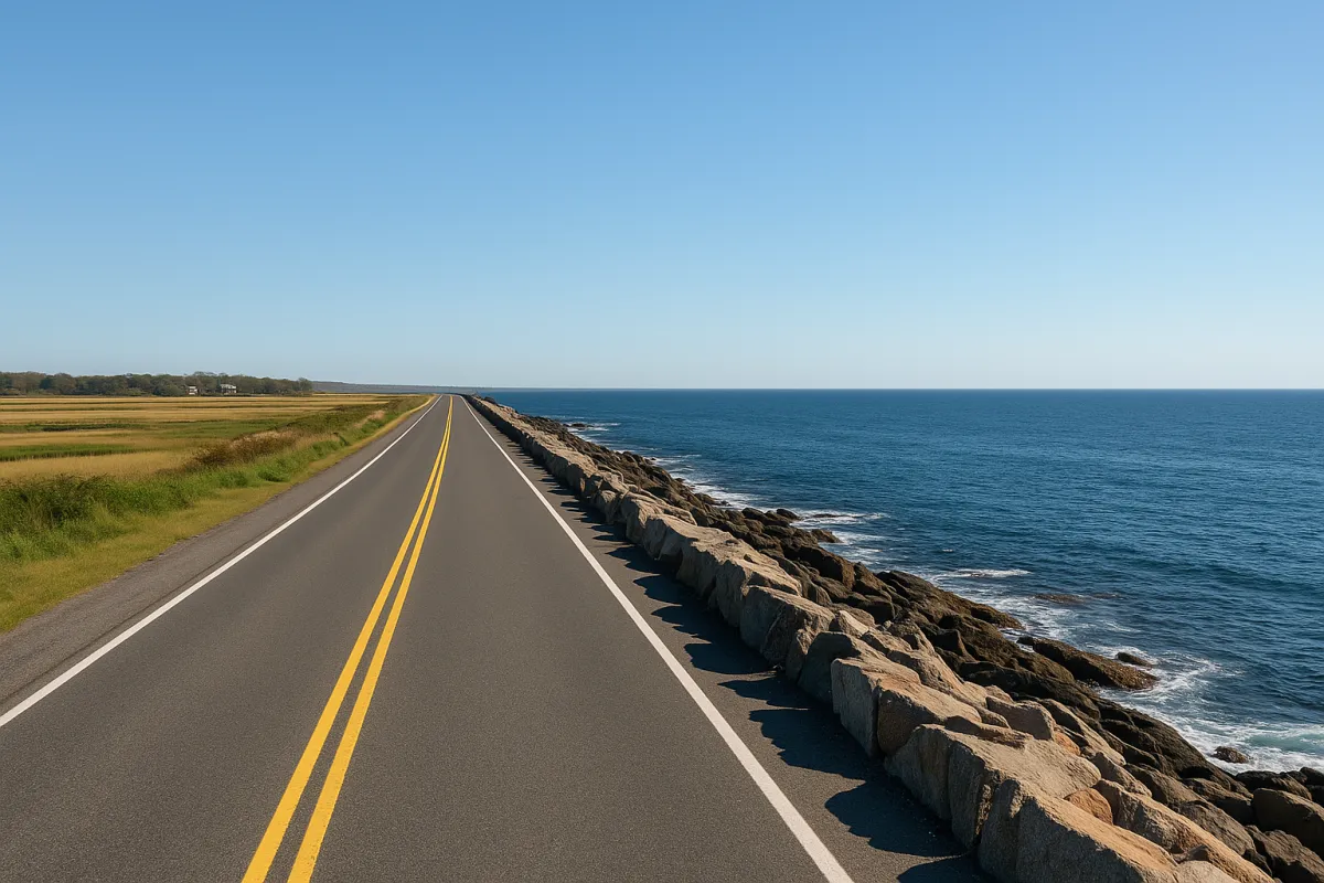
This is not a highway drive. It follows the coastline through real town centers, so the pace is slower and the experience is richer for it. That is part of the point.
The Essex Coastal Scenic Byway website has full maps, suggested itineraries, and town-by-town guides to help you plan your route in detail before you go.
The Route
Here is a look at what you will find along the byway, traveling north from Lynn.
Lynn

Lynn is where the byway begins. Lynn Heritage State Park tells the story of the city's history as one of the most productive shoe manufacturing centers in 19th-century America. The Lynn Shore Drive runs along a generous stretch of ocean frontage along Nahant Bay, with views that set the tone for everything north of it.
Lynn's coastline is often overlooked in favor of towns farther up the road, but its waterfront and working-class history deserve more attention than they typically get.
Into Salem

Salem, MA carries more layered history than almost any city in the country. Most people arrive knowing about the 1692 witch trials, and the sites connected to that period are well-documented throughout the city. The Salem Heritage Trail — a red line painted along the sidewalk — connects the key historical points, including the Salem Witch Trials Memorial and the historic Burying Point cemetery.
But Salem's deeper story is maritime. It was one of the first major ports in the American colonies, and during the late 18th and early 19th centuries, Salem merchants traded globally at a scale that generated extraordinary wealth. Derby Wharf, the Salem Custom House, and the surrounding waterfront are part of Salem Maritime National Historic Site, managed by the National Park Service — and admission is free.
The House of the Seven Gables, built in 1668, stands on Derby Street and is open for tours. The Peabody Essex Museum holds one of the country's finest collections of maritime art, global trade artifacts, and American creative work. Salem rewards more time than most first-time visitors plan to give it.
Beverly's Shore

Beverly sits directly across the harbor from Salem, connected by a bridge over Beverly Harbor. Its downtown along Cabot Street has an active local character with independent shops and restaurants. The harbor area and waterfront trails give access to the water without the intensity of Salem's tourist district.
Beverly Farms, the town's northern village near the Manchester town line, is a quieter stretch of the byway with its own historic personality and coastal views. If you have time for a slow walk, this area is worth the detour.
Manchester-by-the-Sea

Manchester-by-the-Sea has a well-kept town center and one of the most talked-about beaches on the entire North Shore. Singing Beach takes its name from the sound the sand makes underfoot — a soft squeak produced by the particular grain size of the sand there. It is a genuine natural curiosity.
Parking and beach access at Singing Beach have seasonal policies that can change from year to year. Check the town's website for current access information and parking rules before visiting.
The town's harbor, shoreline trails, and compact main street make Manchester a worthwhile stop even if the beach is not the primary goal.
In Gloucester

Gloucester, MA may be the single most historically significant stop on the entire byway.
Founded in 1623, Gloucester is one of the oldest continuously operating fishing ports in the United States. The Man at the Wheel statue — formally titled The Gloucester Fishermen's Memorial — stands at Stacy Boulevard overlooking the harbor, honoring the thousands of fishermen who left the port and never returned. The inscription reads: They That Go Down to the Sea in Ships. It is not a quiet monument.
The Cape Ann Museum covers Gloucester's history through its fishing industry, granite quarrying trade, and its significant role in American art. Rocky Neck, in East Gloucester, has operated as a working artists' colony since the 19th century — one of the oldest continuously active in the country. Galleries and studios remain there today.
Hammond Castle in the Magnolia section of Gloucester is unlike anything else along the byway. Built in the late 1920s and early 1930s by inventor John Hays Hammond Jr., it is a stone castle with a medieval great hall, Roman-era artifacts, and a massive pipe organ — sitting directly on the rocks above the Atlantic. Tours run seasonally; check the museum's website for current hours and availability.
Good Harbor Beach and Wingaersheek Beach are Gloucester's most popular public beaches. Parking fills early on summer days — an early arrival makes a significant difference.
Rockport's Edge

Rockport sits at the far tip of Cape Ann, and the scenery there tends to stop people mid-sentence.
Bearskin Neck is the town's famous narrow spit of land reaching into the harbor, lined with galleries, studios, and working fish shacks. At the end of it, Motif No. 1 — a weathered red fishing shack — sits in the water with rocks and open sea behind it. It has been painted and photographed by more artists than perhaps any other single structure on the New England coast.
Halibut Point State Park sits at the northernmost tip of Cape Ann, where an abandoned granite quarry meets the Atlantic. On a clear day the views reach Maine. The park has short trails and open rock formations. Check the state park website for current conditions and hours before visiting.
Into Essex

The road back from Cape Ann toward the mainland brings you into Essex — a small town with deep roots in two industries: wooden shipbuilding and antiques.
The Essex Shipbuilding Museum sits along the Essex River and documents the town's centuries of wooden boat construction. Essex-built vessels sailed from Gloucester and other North Shore ports throughout the 19th century, and the museum preserves that legacy with artifacts, tools, and restored hulls.
Essex Main Street is one of the best-known antique destinations on the North Shore, drawing collectors from throughout New England for generations. The town sits along the Essex River estuary at the edge of the Great Marsh — a vast salt marsh system stretching from Cape Ann to New Hampshire that represents one of the most significant coastal ecosystems in the northeastern United States.
Historic Ipswich

Ipswich, MA surprises most visitors who do not already know its history. The town contains one of the largest concentrations of 17th-century architecture surviving anywhere in the United States — houses built in the 1600s still standing along quiet residential streets, many on their original foundations.
The Ipswich historic district is recognized at the national level, and walking through its older neighborhoods offers a different kind of historical experience than a museum. The scale, the materials, and the setting are original.
Crane Beach, managed by The Trustees of Reservations, is one of the finest barrier beaches in the Northeast. Four miles of sand backed by active dune systems and a wildlife reserve make it a destination worth visiting in every season. Castle Hill on the Crane Estate rises above the beach and hosts events and guided tours throughout the year.
Parking at Crane Beach requires advance planning in summer. Fees and reservation requirements change seasonally — check The Trustees of Reservations website for current access information before your visit.
The Ipswich River and its surrounding watershed support significant wildlife, and the Ipswich River Wildlife Sanctuary, managed by Mass Audubon, is worth noting for visitors interested in birding and natural history.
Newburyport's Waterfront

Newburyport sits at the mouth of the Merrimack River and is one of the best-preserved examples of Federal-era urban architecture in the country. The brick buildings along State Street, Inn Street, and Market Square were built during the city's most prosperous years — the late 18th and early 19th centuries — when Newburyport's shipbuilders and merchants competed at a global scale.
That prosperity is visible in the streetscape today. Newburyport's downtown is walkable, historically layered, and visually coherent in a way that takes sustained preservation effort to maintain.
The Custom House Maritime Museum documents Newburyport's role in American commerce and maritime history. The waterfront has public boardwalks and open views of the Merrimack River, with Maudslay State Park a short drive away for those who want trails along the river.
South of the city, Plum Island is home to Parker River National Wildlife Refuge — a federal refuge protecting more than 4,700 acres of barrier beach, dune, freshwater marsh, and upland habitat. The refuge is open to visitors year-round, with seasonal access restrictions in some areas to protect nesting piping plovers. Check the refuge website for current conditions and rules before your visit.
Newbury and Salisbury

North of Newburyport, the landscape shifts. The road through Newbury and Salisbury opens into wide marsh views and long sky. The Great Marsh continues in both directions, and the sense of the coast as a natural system — rather than a developed one — becomes much more present.
Salisbury Beach marks the northern end of the byway, with a long stretch of public Atlantic beach. Parking and access fees at Salisbury Beach vary seasonally — verify current information through the town's website before your visit.
From the beach at Salisbury, you can look south along the coastline and get a sense of the full distance you have just covered.
Common Questions
What is the Essex Coastal Scenic Byway?
The Essex Coastal Scenic Byway is a federally designated National Scenic Byway running approximately 90 miles along the Massachusetts North Shore, from Lynn to Salisbury. It connects the coastal communities of Essex County and is recognized for its scenic, historic, recreational, cultural, and natural qualities.
How long does it take to drive the full byway?
You can cover the driving distance in a single day, but stopping to explore changes the math significantly. Most people find that doing the full byway justice requires multiple outings — two or three towns per trip gives you room to actually see each place rather than just pass through it.
What is the best time of year to visit?
The byway is accessible year-round, and each season offers something different. Summer brings beach access and open attractions, along with heavier traffic and parking pressure. Fall offers quieter roads and dramatic coastal light. Spring and winter have their own appeal, particularly for marsh landscapes and off-season town exploration.
Are there fees to access the byway?
The byway itself follows public roads, so there is no cost to drive it. Individual destinations — Crane Beach, state parks, museums, and some parking areas — charge their own fees. Checking each location's website in advance is the most reliable way to avoid surprises.
Which towns are the best starting points for first-time visitors?
Salem and Gloucester have the most concentrated historical content and the longest list of named sites and museums. Rockport and Newburyport are strong for walkable town centers. Ipswich and Essex reward visitors who prefer a quieter, more discovery-based experience.
Plan Ahead
Traffic and parking vary significantly by town and season. Beaches like Crane Beach, Singing Beach, Good Harbor Beach, and Wingaersheek Beach fill early on warm summer days. Many parking areas charge seasonal fees. Always verify current parking rules through the relevant town or park website.
Seasonal access affects several key destinations. Parker River National Wildlife Refuge closes portions of Plum Island seasonally for piping plover nesting. State park hours, museum schedules, and individual attraction hours all shift between seasons and can change year to year. Check before you go.
The byway is not a single road. It follows a combination of local and state routes through active communities. This is what makes it interesting, but it also means the drive changes character constantly and benefits from navigation preparation in advance.
Off-season visits offer a meaningfully different experience — quieter streets, easier parking, and a clearer sense of each town outside of peak conditions.
Final Thoughts
The Essex Coastal Scenic Byway is one of those routes that rewards going slowly. Not every town needs a full day, but almost every town deserves more than a windshield view. The history along this stretch of the Massachusetts coast is layered in a way that takes time to absorb — colonial-era architecture standing a few miles from a medieval castle, a working art colony next to a fishing memorial, a Federal-era port city at the edge of a wildlife refuge.
There is no single right way to drive it. The byway is best treated as an ongoing project — a stretch of the North Shore to return to, town by town, season by season, until the full picture comes into focus.
For current maps, suggested routes, and town-by-town guides, the Essex Coastal Scenic Byway website is the authoritative starting point.
